Site Information - Diagrams
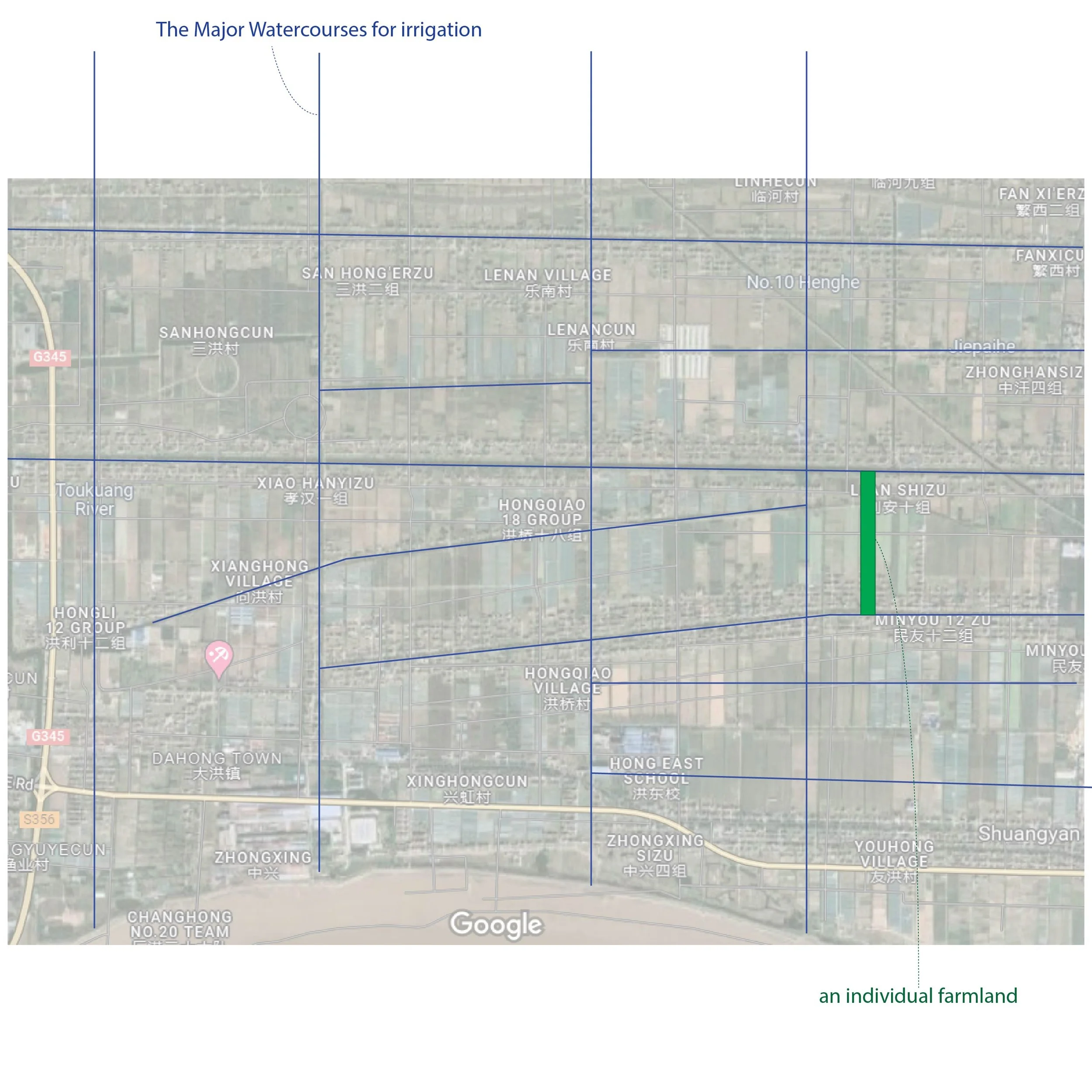
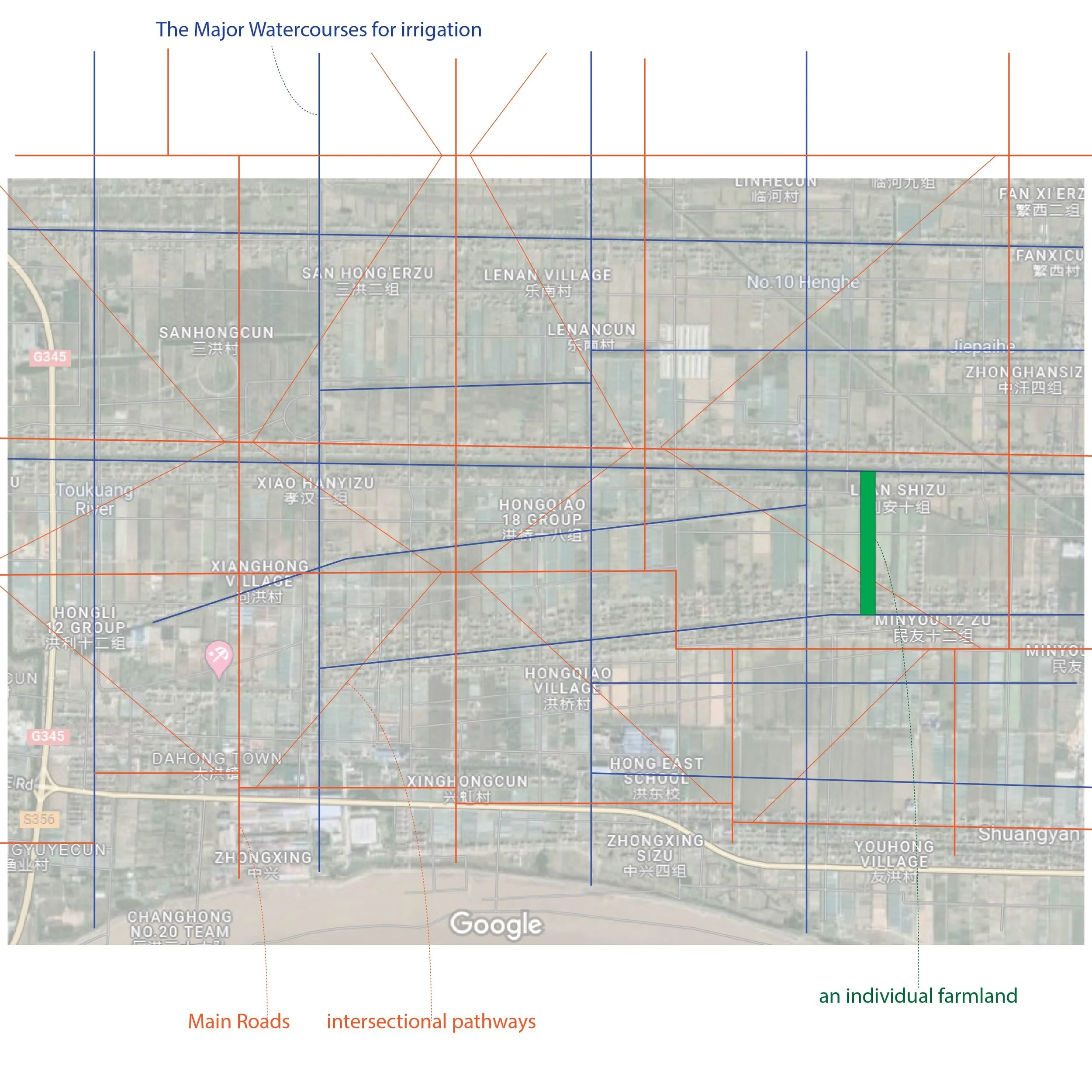
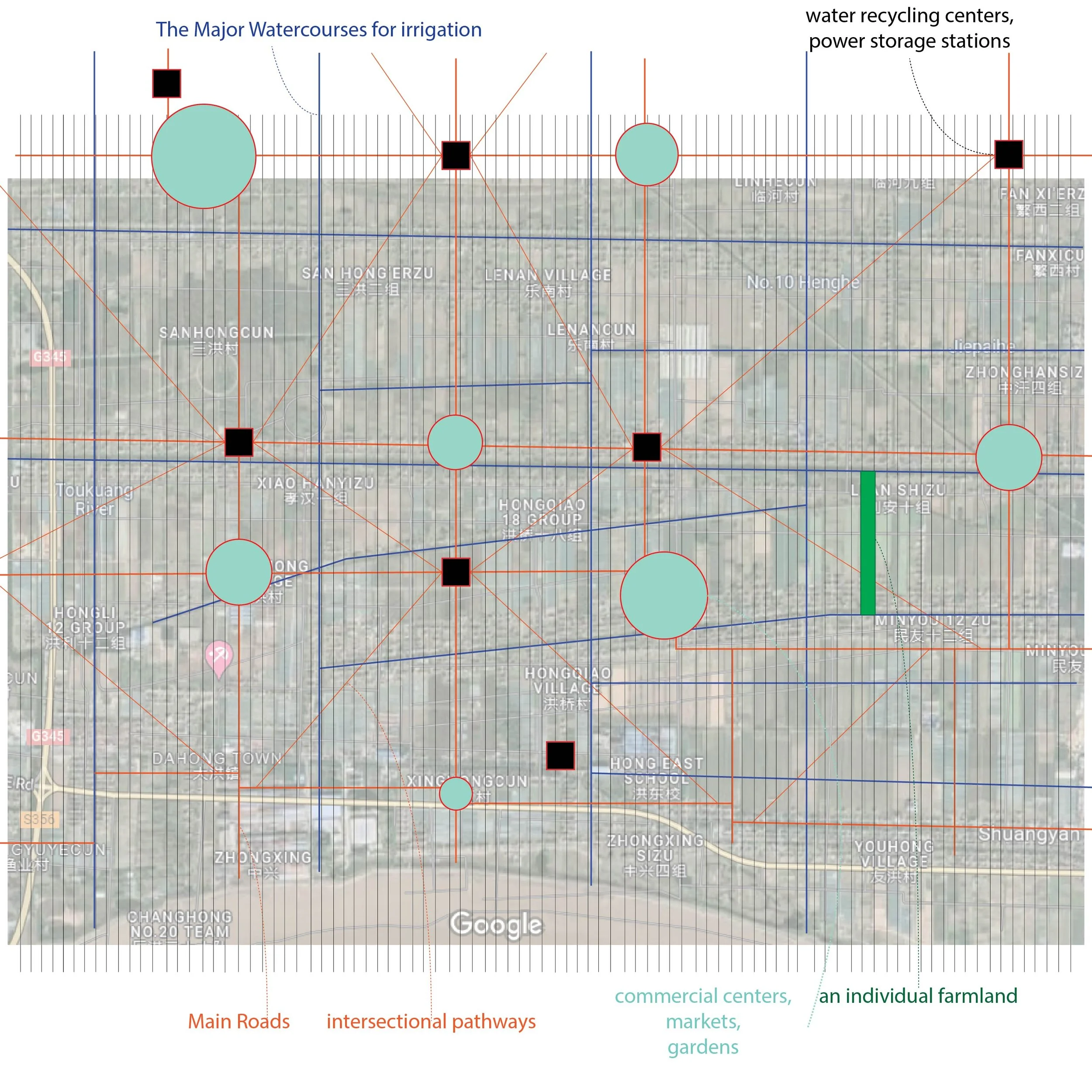
This page tells the basic information of the chosen site for testing my theory of regarding a city or town as a dynamic system like a living organism. The geographic location of this site is in a suburb region near Shanghai, one of the most critical social and economic centers of China. The area is mainly covered by rural farmlands with traditional farming methods. The following diagrams especially explain the components that constitute the domestic farming and industrial systems: farmlands, major agricultural watercourses, the proposed traffic routes (roads on the ground level), and the intersections (circles=commercial, public gardens; black squares=energy recycling and management centers).

Please click on the arrows to view the details in the slideshow below :


